

Oceania·Cook Islands
UPDATE: RSMC Nadi has cancelled the gale warning for Suwarrow, Pukapuka and Nassau and the tropical cyclone warning for Northern Cooks land areas, leaving a strong wind warning for five islands, in its last special bulletin on Category 1 Cyclone Xavier
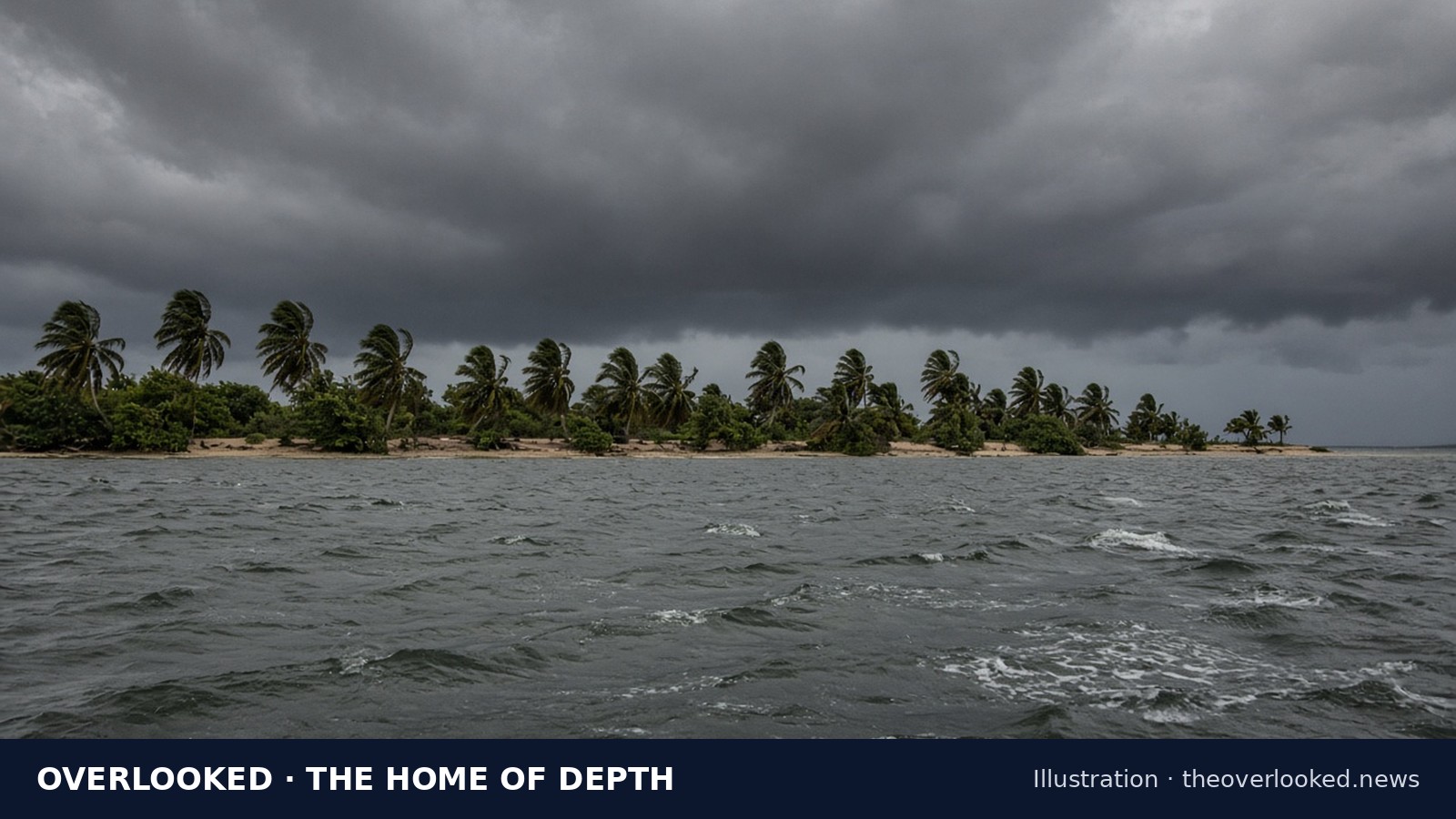
MANIHIKI, Cook Islands —
| Score | Meaning | Major U.S. outlets that covered it |
|---|---|---|
| 10 | Fully overlooked ← this story | 0 of 13 outlets |
| 8 | Barely covered | 1 outlet |
| 6, 5 | Lightly covered | 2 outlets (6) · 3 outlets (5) |
| 4, 3 | Covered | 4 outlets (4) · 5 outlets (3) |
| 2, 1, 0 | Widely covered | 6–7 outlets (2) · 8–10 outlets (1) · 11–13 outlets (0) |
Provisional: Search-based provisional check about 10:28-10:33 PM ET, Nov. 15, 2026: outlets were checked by grouped WebSearch topic and site-batch queries, not by opening each outlet's own site search (direct_outlet_open not attempted for the 13); search-index coverage of the last 24-48 hours is incomplete; absence is not proven. Not a locked final score.
Why this is in the archive: We published this as breaking news at 11:07 PM ET on Nov 15, 2026. Breaking stories stay on the Breaking page for 24 hours, so it was moved to the archive at 11:07 PM ET on Nov 16, 2026. Its link has not changed. (Not yet logged; the daily recheck will record it.)
Updates
- UPDATE (Nov. 20, evening ET): RSMC Nadi, the Fiji Meteorological Service's regional cyclone centre, in Special Weather Bulletin Number "FORTY-SIX" for the Northern Cooks, issued "Nov 210008 UTC" (7:08 p.m. ET on Nov. 20, Overlooked's conversion), says "TROPICAL CYCLONE WARNING IS NOW CANCELLED FOR NORTHERN COOKS LAND" and, on the next line, "AREAS". It says "A GALE WARNING PREVIOUSLY IN FORCE FOR SUWARROW, PUKAPUKA AND NASSAU" and, on the next line, "IS NOW CANCELLED." It says "A STRONG WIND WARNING REMAINS IN FORCE FOR SUWARROW, PUKAPUKA," and, on the next line, "NASSAU, MANIHIKI AND RAKAHANGA." Bulletin FORTY-SIX lists no other warning in force for the Northern Cooks. Its previous bulletin, Number FORTY-FIVE, issued at 3:29 p.m. ET, had said "A GALE WARNING REMAINS IN FORCE FOR SUWARROW, PUKAPUKA AND NASSAU." So Suwarrow, Pukapuka and Nassau have moved from a gale warning to a strong wind warning. Bulletin FORTY-SIX says "TROPICAL CYCLONE XAVIER [994 HPA] CATEGORY 1 WAS LOCATED NEAR 11.4" and, on the next line, "DEGREES SOUTH 164.1 DEGREES WEST OR ABOUT 160 KILOMETRES EAST OF" and "NASSAU OR 230 KILOMETRES NORTH-NORTHWEST OF SUWARROW AT 202300UTC" (the bulletin's local time is "1PM CKT TODAY"; 6:00 p.m. ET on Nov. 20, Overlooked's conversion). It gives "MAXIMUM SUSTAINED WINDS OF ABOUT 65" kilometres per hour close to the centre and "GUST UP TO 90 KILOMETERS" per hour, and says "XAVIER IS GRADUALLY MOVING WEST-SOUTHWEST AT ABOUT 9KM/HR." Bulletin FORTY-FIVE had put Xavier at "[991 HPA] CATEGORY 1" with "MAXIMUM SUSTAINED WINDS OF ABOUT 85" kilometres per hour. Bulletin FORTY-SIX says "XAVIER CONTINUES TO WEAKEN AND ON THIS FORECAST TRACK, IT IS NOT" and, on the next line, "EXPECTED TO BRING ANY DAMAGING WINDS OVER SUWARROW, PUKAPUKA AND" Nassau, adding: "HOWEVER, STRONG WINDS IS EXPECTED AS THE SYSTEM TRACKS" and, on the next line, "TOWARDS THE SOUTHWEST TONIGHT." For Suwarrow, Pukapuka and Nassau, it forecasts "STRONG WIND SPEEDS UP TO 55KM/HR AND MOMENTARY GUSTS UP TO 80KM/HR." and a "RISK OF COASTAL INUNDATION DURING HIGH TIDES." For Manihiki and Rakahanga, it forecasts "STRONG WINDS OF UP TO 45KM/HR WITH GUSTS UP TO 80KM/HR." For mariners, it says "GALE FORCE WINDS WITH WIND SPEEDS UP TO 35 KNOTS AND HIGH SEAS OUT TO" and, on the next line, "ABOUT 70 NAUTICAL MILES FROM THE CENTER." RSMC Nadi issued a newer marine warning after Bulletin FORTY-SIX: its "GALE WARNING 027", issued "Nov 210048 UTC" (7:48 p.m. ET on Nov. 20, Overlooked's conversion), says "THIS WARNING CANCELS AND REPLACES WARNING 026." It says "TROPICAL CYCLONE XAVIER CENTRE 995HPA CATEGORY 1 WAS LOCATED NEAR 11.5 SOUTH" and, on the next line, "164.3 WEST AT 210000 UTC." (7:00 p.m. ET on Nov. 20), an hour after Bulletin FORTY-SIX's position. It says "CYCLONE MOVING WEST SOUTHWEST AT 6 KNOTS. CYCLONE WEAKENING." and "EXPECT SUSTAINED WINDS OF 35 KNOTS CLOSE TO THE CENTRE." RSMC Nadi's Tropical Disturbance Advisory Number "A26", issued "Nov 210137 UTC" (8:37 p.m. ET on Nov. 20, Overlooked's conversion), is newer than Advisory A25, cited in the earlier Nov. 20 update below. It says "TROPICAL CYCLONE XAVIER CENTRE 995HPA WAS LOCATED NEAR 11.5S 164.3W" and, on the next line, "AT 210000 UTC." (7:00 p.m. ET on Nov. 20), with the cyclone moving "WEST SOUTHWEST AT" and, on the next line, "ABOUT 6 KNOTS." It says "MAXIMUM 10-MINUTE AVERAGE WINDS NEAR THE CENTRE" and, on the next line, "ESTIMATED AT ABOUT 35 KNOTS. TC XAVIER WEAKENING." Its forecast says "AT 12 HRS VALID AT 211200 UTC 12.0S 165.3W MOV WSW AT 06 KT WITH 35" knots close to the centre (7:00 a.m. ET on Nov. 21), and the next advisory "WILL BE ISSUED AROUND 210800UTC OR EARLIER." (3:00 a.m. ET on Nov. 21). Bulletin FORTY-SIX says "THIS IS THE LAST SPECIAL WEATHER BULLETIN ON TROPICAL CYCLONE XAVIER" and, on the next line, "FOR NORTHERN COOKS AND THE NEXT BULLETIN WILL BE THE ROUTINE WEATHER" bulletin. These readings replace, as Xavier's current warnings, intensity and position, the Bulletin FORTY-FIVE reading in the earlier Nov. 20 update below and every earlier warning and intensity report on this page; the gale, storm and tropical cyclone warnings and alerts described in those updates are kept only as earlier readings. This update does not change earlier reports of a state of emergency for Nassau. RSMC Nadi times are UTC as published, with ET conversions. Source: RSMC Nadi (Fiji Meteorological Service), RSMC Nadi (Fiji Meteorological Service), RSMC Nadi (Fiji Meteorological Service), RSMC Nadi (Fiji Meteorological Service)
- UPDATE (Nov. 20, afternoon ET): RSMC Nadi, the Fiji Meteorological Service's regional cyclone centre, in Special Weather Bulletin Number "FORTY-FIVE" for the Northern Cooks, issued "Nov 202029 UTC" (3:29 p.m. ET on Nov. 20, Overlooked's conversion), says "A GALE WARNING REMAINS IN FORCE FOR SUWARROW, PUKAPUKA AND NASSAU." and "A STRONG WIND WARNING REMAINS IN FORCE FOR MANIHIKI AND RAKAHANGA." Its previous bulletin, Number FORTY-FOUR, issued at 12:36 p.m. ET, had said "A STRONG WIND WARNING REMAINS IN FORCE FOR PUKAPUKA." So Pukapuka has moved from a strong wind warning to a gale warning; Bulletin FORTY-FIVE's word "REMAINS" is as written. Bulletin FORTY-FIVE says "TROPICAL CYCLONE XAVIER [991 HPA] CATEGORY 1 WAS LOCATED NEAR 11.3" and, on the next line, "DEGREES SOUTH 163.7 DEGREES WEST OR ABOUT 200 KILOMETRES EAST OF" Nassau at "201800UTC" (the bulletin's local time is "8AM CKT TODAY"; 1:00 p.m. ET, Overlooked's conversion), with "MAXIMUM SUSTAINED WINDS OF ABOUT 85" kilometres per hour close to the centre and "GUST UP TO 120" kilometres per hour. It says "XAVIER CONTINUES TO WEAKEN" and, on the forecast track, expects it "TO BE ABOUT 110KM EAST-SOUTHEAST OF NASSAU OR 220KM NORTHWEST OF" and, on the next line, "SUWARROW BY 210600UTC [8PM CKT TODAY]." (1:00 a.m. ET on Nov. 21). Overlooked is publishing the bulletin's own "OR" wording as written. For Suwarrow, Pukapuka and Nassau, the bulletin forecasts "DAMAGING GALE FORCE WINDS WITH WIND SPEEDS UP TO 85KM/HR AND" "MOMENTARY GUSTS UP TO 120KM/HR. WINDS GRADUALLY EASING TO FRESH TO" strong from tomorrow, and a "RISK OF COASTAL INUNDATION DURING HIGH TIDES." It says the next bulletin "WILL BE ISSUED AT OR BEFORE 210000UTC" (7:00 p.m. ET on Nov. 20). RSMC Nadi's products differ on which way Xavier is moving, and Overlooked is not choosing between them. Bulletin FORTY-FIVE says "XAVIER IS GRADUALLY MOVING WEST AT ABOUT" and, on the next line, "11KM/HR." RSMC Nadi's Gale Warning 026, issued at 2:08 p.m. ET, says "CYCLONE MOVING WEST AT 6 KNOTS." Its Tropical Disturbance Advisory Number "A25", issued "Nov 201942 UTC" (2:42 p.m. ET), for the same 1800 UTC position, says "CYCLONE MOVING SOUTH AT ABOUT 6" knots and "TC XAVIER WEAKENING." Its forecasts say "AT 12 HRS VALID AT 210600 UTC 11.9S 164.7W MOV WSW AT 06 KT WITH 35" knots close to the centre, and "GLOBAL MODELS AGREE IN FURTHER WEAKENING OF THIS SYSTEM AND MOVE" Xavier west-southwest. These readings replace, as Xavier's current warnings, intensity and position, the Bulletin FORTY-FOUR reading in the earlier Nov. 20 update below and every earlier intensity report on this page; those are kept only as earlier readings. Gale Warning 026 was still RSMC Nadi's latest marine warning on its feed at 4:13 p.m. ET. The state of emergency for Nassau is unchanged in this update. RNZ Pacific and Cook Islands News had no newer Xavier report on their news pages as of 4:14 p.m. ET, Nov. 20. RSMC Nadi times are UTC as published, with ET conversions. Source: RSMC Nadi (Fiji Meteorological Service), RSMC Nadi (Fiji Meteorological Service), RSMC Nadi (Fiji Meteorological Service), RSMC Nadi (Fiji Meteorological Service)
- UPDATE (Nov. 20, later): RSMC Nadi, the Fiji Meteorological Service's regional cyclone centre, now puts Xavier at Category 1. Its Gale Warning 026 for mariners, issued "Nov 201908 UTC" (2:08 p.m. ET on Nov. 20, Overlooked's conversion), says "TROPICAL CYCLONE XAVIER CENTRE 991HPA CATEGORY 1 WAS LOCATED NEAR 11.3 SOUTH" and, on the next line, "163.7 WEST AT 201800 UTC." (1:00 p.m. ET). It says "CYCLONE MOVING WEST AT 6 KNOTS. CYCLONE WEAKENING." and "EXPECT SUSTAINED WINDS OF 45 KNOTS CLOSE TO THE CENTRE, DECREASING TO 35 KNOTS" by "210600 UTC" (1:00 a.m. ET on Nov. 21). RSMC Nadi's latest Special Weather Bulletin for the Northern Cooks, Number "FORTY-FOUR", issued "Nov 201736 UTC" (12:36 p.m. ET on Nov. 20), says: "A GALE WARNING REMAINS IN FORCE FOR SUWARROW AND NASSAU." "A STRONG WIND WARNING REMAINS IN FORCE FOR MANIHIKI AND RAKAHANGA." "A STRONG WIND WARNING REMAINS IN FORCE FOR PUKAPUKA." That bulletin, which uses an earlier position fix than the gale warning, says "TROPICAL CYCLONE XAVIER [985 HPA] CATEGORY 2 WAS LOCATED NEAR 11.8" and, on the next line, "DEGREES SOUTH 163.7 DEGREES WEST OR ABOUT 210 KILOMETRES EAST OF" Nassau at "201500UTC" (the bulletin's local time is "5AM CKT TODAY"; 10:00 a.m. ET, Overlooked's conversion), with "MAXIMUM SUSTAINED WINDS OF ABOUT 95" kilometres per hour close to the centre and "GUST UP TO 130" kilometres per hour. It says "XAVIER CONTINUES TO WEAKEN" and, on the forecast track, expects it "TO BE ABOUT 130KM EAST-SOUTHEAST OF NASSAU OR 190KM NORTHWEST OF" and, on the next line, "SUWARROW BY 210300UTC [5PM CKT TODAY] AND ABOUT 90KM SOUTH-SOUTHWEST" (210300 UTC is 10:00 p.m. ET on Nov. 20), then "OF NASSAU OR ABOUT 300KM WEST-NORTHWEST OF SUWARROW BY 21150UTC [5AM" and "CKT TOMORROW." Overlooked is publishing the bulletin's own "OR" wording and its "21150UTC" time stamp as written, and is not resolving either. For Suwarrow and Nassau, the bulletin forecasts "DAMAGING GALE FORCE WINDS WITH WIND SPEEDS UP TO 85KM/HR AND" "MOMENTARY GUSTS UP TO 120KM/HR. WINDS GRADUALLY EASING TO FRESH TO" strong from tomorrow, and a "RISK OF COASTAL INUNDATION DURING HIGH TIDES." It says the next bulletin "WILL BE ISSUED AT OR BEFORE 202100UTC" (4:00 p.m. ET on Nov. 20). These readings replace, as Xavier's current intensity and position, the Special Weather Bulletin Number FORTY-THREE reading in the earlier Nov. 20 update below and every earlier intensity report on this page, including the Nov. 19 reports that Xavier had been downgraded to Category 4; those are kept only as earlier readings. Cook Islands News (Melina Etches), in a report published at 2:18 p.m. ET on Nov. 20 (page metadata), says "relief supplies and humanitarian support are being mobilised to assist the Northern Group islands" and that "Te Kukupa II is on standby to depart Rarotonga on Saturday, weather permitting, carrying the first consignment of relief supplies to the Pa Enua." It reports that on Pukapuka "all 377 residents had moved into the cyclone shelter", while "Nassau’s 84 residents were sheltering in the strongest houses in the middle of the island." It says Pukapuka resident Anna Katoa "reported that many coconut trees along the coastline had fallen". The paper says Prime Minister Mark Brown confirmed that "funding had been released through the Pacific Catastrophic Risk Insurance Company (PCRIC) to help meet the costs of the cyclone response." Days such as "Saturday" are as Cook Islands News published them. The state of emergency for Nassau is unchanged in this update. RNZ Pacific had no newer Xavier report on its Pacific news page as of 2:23 p.m. ET, Nov. 20, and the Cook Islands Meteorological Service's website did not open (the connection failed). RSMC Nadi times are UTC as published, with ET conversions. Source: RSMC Nadi (Fiji Meteorological Service), RSMC Nadi (Fiji Meteorological Service), Cook Islands News (Melina Etches)
- UPDATE (Nov. 20): RSMC Nadi, the Fiji Meteorological Service's regional cyclone centre, in Special Weather Bulletin Number "FORTY-THREE" for the Northern Cooks, issued "Nov 201436 UTC" (9:36 a.m. ET on Nov. 20, Overlooked's conversion), says "TROPICAL CYCLONE XAVIER [975 HPA] CATEGORY 2 WAS LOCATED NEAR 11.4" and, on the next line of the same bulletin, "DEGREES SOUTH 163.1 DEGREES WEST", at "201200UTC" (the bulletin's local time on that line is "2AM CKT"; 7:00 a.m. ET, Overlooked's conversion). It says "TC XAVIER HAS MAXIMUM SUSTAINED WINDS OF ABOUT 100 KILOMETERS" per hour close to the centre, and "XAVIER IS GRADUALLY MOVING WEST-SOUTHWEST AT ABOUT 5KM/HR." "A GALE WARNING REMAINS IN FORCE FOR SUWARROW AND NASSAU." "A STRONG WIND WARNING REMAINS IN FORCE FOR MANIHIKI AND RAKAHANGA." "A STRONG WIND WARNING REMAINS IN FORCE FOR PUKAPUKA." On the forecast track, the bulletin says Xavier is expected "TO BE ABOUT 150KM EAST-SOUTHEAST OF NASSAU OR 180KM NORTHWEST OF" and, on the next line, "NASSAU BY 210000UTC [2PM CKT TODAY] AND ABOUT 80KM SOUTH-SOUTHEAST OF" then "NASSAU OR ABOUT 270KM WEST-NORTHWEST OF SUWARROW BY 21120UTC [2AM CKT" and, on the next line, "TOMORROW." Overlooked is publishing the bulletin's own "OR" wording and the bulletin's own "21120UTC" time stamp as written, and is not resolving either. This official Category 2 reading supersedes, as the current intensity, earlier reports still on this page that Xavier had been downgraded to Category 4. RNZ Pacific reported on Nov. 20 that the Fiji track showed the storm is "expected to pass south of the island this weekend as a category 3 or 2 storm." The state of emergency for Nassau is unchanged in this update. Cook Islands Meteorological Service's own website was not opened (the connection failed); the intensity and track figures are from RSMC Nadi's official bulletin. Source: RSMC Nadi (Fiji Meteorological Service), RNZ Pacific
- UPDATE (Nov. 19): Cook Islands News, in a report dated Thursday 19 November 2026, says Prime Minister Mark Brown "has declared a State of Emergency over the island of Nassau in response to the forecast impact of Severe Tropical Cyclone Xavier." "The declaration came into effect at 12:00am on Thursday 19 November 2026, Cook Islands time." PMN News, published 20 November 2026 at 10:05am, says "Prime Minister Mark Brown made the declaration from 11pm on Thursday (NZ time)" after Emergency Management Cook Islands said the island's limited capacity meant an emergency response was needed. PMN also reported "No casualties or damage had been reported on Nassau as of late Thursday (NZT)." RNZ Pacific, in a 20 November 2026, 11:40am item, reports that "Cook Islands Prime Minister Mark Brown has declared a state of emergency for Nassau Island in response to the forecast impact of Tropical Cyclone Xavier," and that the Fiji Meteorological Service's latest forecast track "shows the storm is expected to pass south of the island this weekend as a category 3 or 2 storm." Each clock time is kept with the timezone the outlet published. This update does not change earlier reports that Xavier had been downgraded to Category 4. Source: Cook Islands News (Supplied), PMN News, RNZ Pacific
- UPDATE (Nov. 18, later): Tropical Cyclone Xavier "has been downgraded to a category 4 storm, but warnings remain in place in the Northern Cook Islands", RNZ Pacific reported in a story stamped 9:08 a.m. on Nov. 19, New Zealand time (3:08 p.m. ET on Nov. 18, Overlooked's conversion). RNZ says "Xavier's maximum sustained winds have dropped to about 175km/h" and that the Fiji Meteorological Service's forecast track shows the storm "set to drop to a category 3 system in the next 12 hours, and pass just south of Nassau over the coming days." Pukapuka and Nassau "remain under a gale warning, with a strong wind warning still in place for Manihiki and Rakahanga", and uninhabited Suwarrow is under a tropical cyclone alert, RNZ reports. The Cook Islands government "has accepted New Zealand's offer to deploy two rapid response team personnel to assist with humanitarian coordination and emergency operations", according to RNZ. Cook Islands News, in its Wednesday, Nov. 18 edition, reports: "It was confirmed that as of 8pm yesterday, the two experienced personnel from New Zealand's Rapid Response Team arrived". The paper also reports: "On Monday evening, more than 300 people were evacuated to the cyclone shelter on Pukapuka". On Manihiki, where a resident had reported some damage to wharves (see the earlier Nov. 18 update below), Cook Islands News now says the island "reported improving weather conditions, with rain and wind easing and no serious damage reported." Source: RNZ Pacific, Cook Islands News (Melina Etches)
- UPDATE (Nov. 18): Cook Islands Meteorological Service director Maara Vaiimene told RNZ Pacific that Xavier, now a category 5 system, is moving west-southwest, "Which means it will pass close to Pukapuka and Nassau, and moving away from Manihiki and Rakahanga in the next day or two". RNZ says "Vaiimene expects the worst of the cyclone to hit Pukapuka and Nassau will be tonight to Friday morning New Zealand time." RNZ's report is stamped 4:47 p.m. on Nov. 18, New Zealand time (10:47 p.m. ET on Nov. 17, Overlooked's conversion). Vaiimene said the Northern Cook Islands "have activated their safety centre". Emergency Management Cook Islands said "damaging gale-force winds, heavy rainfall, dangerous seas and coastal inundation remain significant threats, particularly for Pukapuka and Nassau", 1News reports. Cook Islands News, reporting the agency's account, says "Vulnerable residents have been relocated to designated safety shelters, while schools across the Northern Group have been closed as a precaution." It also reports that "Nassau, which has no designated cyclone shelter, was also preparing for Xavier" and that "The island has 16 households". A resident on Manihiki said the "worst is over" for his island, 1News reports, and Jean Marie Williams told RNZ Pacific Waves: "At the moment we have some damages on wharves." That is one resident's account; no official damage assessment has been reported. Williams said power is the main concern on Manihiki: "we only have power when the sun comes out". Source: RNZ Pacific, 1News (Christina Persico of RNZ), Cook Islands News (Melina Etches)
- UPDATE (Nov. 17, later): RSMC Nadi, the Fiji Meteorological Service's regional cyclone centre, now puts Xavier at Category 5. Its Hurricane Warning 013, "ISSUED FROM RSMC NADI NOV 171245 UTC" (7:45 a.m. ET on Nov. 17), says "SEVERE TROPICAL CYCLONE XAVIER CENTRE 915HPA CATEGORY 5 WAS LOCATED NEAR 9.3 SOUTH 163.9 WEST AT 171200 UTC" (7:00 a.m. ET). The warning gives Category 5 as Xavier's current status in its position report, not as a forecast. It says "CYCLONE MOVING WEST AT 7 KNOTS" and tells ships to "EXPECT SUSTAINED WINDS OF 115 KNOTS CLOSE TO THE CENTRE INCREASING TO 120 KNOTS BY 181200 UTC." This replaces the Category 4 status in the earlier Nov. 17 update. That update relied on an RNZ Pacific report dated 10:00 p.m. on Nov. 17, New Zealand time (4:00 a.m. ET), which predates Warning 013. When Overlooked reopened the MetService page at about 9:24 a.m. ET, its bulletin, labelled "Issued: 9:40pm Tue, 17 Nov" (New Zealand time; 3:40 a.m. ET), still described "Severe Tropical Cyclone Xavier (925 hPa, Category 4)" and said it "could rise to category 5 strength overnight into Wednesday morning"; MetService says its next bulletin "will be issued by 1pm Wed, 18 Nov." The warning was read on a College of DuPage NexLab mirror of RSMC Nadi's marine warnings, not on the Fiji Meteorological Service's own site. RSMC Nadi times are UTC as published. Source: RSMC Nadi (Fiji Meteorological Service), Hurricane Warning 013, MetService (Tropical Cyclone Activity bulletin)
- UPDATE (Nov. 17): RNZ Pacific reports that "Tropical Cyclone Xavier is now a category 4 cyclone as it continues to swirl in waters of the Northern Cook Islands," and that the Cook Islands Meteorological Service said "severe Tropical Cyclone Xavier winds are now reaching 165kph with gusts of upto 240kph near its centre" (spelling as published). Matangi Tonga says Xavier "was upgraded to category 4 tonight, located about 1850 km northeast of Nuku'alofa," and that a Fiji Meteorological Service marine warning issued Tuesday evening put it at "centre 925HPA, CAT 4," "intensifying, with sustained winds of 105 knots close to the centre," "increasing to 120 knots during the night." MetService, in a bulletin "Issued: 9:40pm Tue, 17 Nov" (New Zealand time), says "Maximum winds near the centre are 105kt (170km/h) on Tuesday evening" and that Xavier "could rise to category 5 strength overnight into Wednesday morning." Category 5 is a forecast, not an observation. RNZ says "A gale warning is still in force for Manihiki and Rakahanga, and a gale alert is effective for Pukapuka, Nassau and Suwarrow," and that Emergency Management Cook Islands "has urged residents to remain in safe shelter, avoid coastal areas." MetService says "it is expected to move away from the Northern Cook Islands over the weekend and towards Samoa," but "confidence in the forecast track and intensity during the outlook period remains low." Matangi Tonga says the storm "was not expected to pose any direct threat to Tonga in the next 24 to 48 hours." Times are local as published. None of the sources reported damage or injuries at the time of this check. Source: RNZ Pacific, Matangi Tonga, MetService (Tropical Cyclone Activity bulletin)
- UPDATE (Nov. 16): FBC News reports that "Tropical Cyclone Xavier has intensified to a Category Three system and continues to affect the Northern Cook Islands," with "sustained winds of up to 65 knots (120 km/hr), with gusts reaching 90 knots (170 km/hr)," and that "TC Xavier is forecast to further intensify and is likely to reach Category Four within the next 24 hours." Fiji One News says "Forecasts indicate TC Xavier could reach Category 4 strength within the next 24 hours," and PMN News reports that Xavier "is forecast to become a Category 4 cyclone within the next 24 hours." Category 4 is a forecast. RSMC Nadi Hurricane Warning 010, already cited in this story, was still the latest warning on the mirror when News Desk reopened it at about 7:38 PM ET, Nov. 16, 2026; it gives "SUSTAINED WINDS OF 65 KNOTS CLOSE TO THE CENTRE INCREASING TO 90 KNOTS BY 171800 UTC," while the outlets describe 90 knots as gusts. FBC says the Fiji Meteorological Service "stresses that there is currently no direct tropical cyclone threat to Fiji." Manihiki resident JeanMarie Williams said, according to a Cook Islands News article dated Monday, Nov. 16, that predates the category 3 reports: "We don't wait for warnings," and "Manihiki Island Government has cut trees on the road side and homes tied down." Emergency Management Cook Islands urged Northern Cook Islands communities to "maintain a heightened state of preparedness over the next 72 hours," Cook Islands News reports. Williams referred to Cyclone Martin, which the paper describes as "the deadly 1997 tropical cyclone that caused significant damage and claimed at least 28 lives." None of the sources reported damage or injuries from Xavier at the time of this check. Source: FBC News, Fiji One News, PMN News, Cook Islands News, RSMC Nadi (Fiji Meteorological Service), Hurricane Warning 010
- UPDATE (Nov. 16): RSMC Nadi (Fiji Meteorological Service) Hurricane Warning 010, issued "NOV 161943 UTC" and marked "CORRECTION TO WARNING", reads "TROPICAL CYCLONE XAVIER CENTRE 979HPA CATEGORY 3 WAS LOCATED NEAR 8.9 SOUTH 162.8 WEST AT 161800 UTC." The same bulletin says "CYCLONE MOVING WEST AT 14 KNOTS. CYCLONE INTENSIFYING" and "EXPECT SUSTAINED WINDS OF 65 KNOTS CLOSE TO THE CENTRE INCREASING TO 90 KNOTS BY 171800 UTC." "THIS WARNING CANCELS AND REPLACES WARNING 009." RNZ Pacific, in a story still dated "17 November 2026, 7:41am" (New Zealand time; Nov. 16 in the U.S.), continues to report that "Tropical Cyclone Xavier has now intensified into a category 2 cyclone" and that "The Fiji Meteorological Service says Xavier is likely to further intensify to a severe tropical cyclone by today (Tuesday)." None of the news reports cited in this update gave category 3; that figure is from the official bulletin only. RSMC Nadi's Tropical Disturbance Advisory WTPS11 (part 2 of 2, "WTPS11 NFFN 161800") says "GLOBAL MODELS ARE MOSTLY IN AGREEMENT WITH A SOUTHWESTWARD MOVEMENT WITH FURTHER INTENSIFICATION OVER THE NEXT 24 TO 48 HOURS HOWEVER DIFFER BEYOND 48 HOURS" and its outlook "AT 36 HRS VALID AT 180600 UTC" gives "95 KT CLOSE TO CENTRE." None of the sources reported damage or injuries at the time of this check. Source: RSMC Nadi (Fiji Meteorological Service), Hurricane Warning 010, RSMC Nadi (Fiji Meteorological Service), Tropical Disturbance Advisory WTPS11
- UPDATE (Nov. 16): RNZ Pacific reports "Tropical Cyclone Xavier has now intensified into a category 2 cyclone" and that the Cook Islands Meteorological Service has put Pukapuka and Nassau under a tropical cyclone alert. RNZ says "A storm warning remains in place for Manihiki and Rakahanga." Samoa Newshub reports "Gale warnings remain in force for Manihiki and Rakahanga, while Pukapuka and Nassau are under tropical cyclone alerts", and The Watchers says RSMC Nadi's Special Weather Bulletin 12 "keeps a gale warning, not a storm warning, for those two atolls". Sources differ on when Xavier reached category 2: Samoa Newshub says the Fiji Meteorological Service confirmed that Xavier "had reached Category 2 by 7 pm Samoa time on Monday, 16 November", while The Watchers says an RSMC Nadi advisory placed it at 06:00 UTC on November 16, "already Category 2". They also cite different central pressures from successive bulletins: Samoa Newshub gives a "central pressure of 985 hectopascals"; The Watchers says Special Weather Bulletin 12 gave "a central pressure of 983 hPa, still Category 2"; and RSMC Nadi Hurricane Warning 009, issued "NOV 161322 UTC", reads "TROPICAL CYCLONE XAVIER CENTRE 982HPA CATEGORY 2". These are forecasts: "The Fiji Meteorological Service says Xavier is likely to further intensify to a severe tropical cyclone by today (Tuesday)", RNZ reports, and The Watchers says Special Weather Bulletin 12 expects that "later on November 16, Cook Islands time". Hurricane Warning 009 says "CYCLONE INTENSIFYING" and expects sustained winds near the centre "INCREASING TO 80 KNOTS BY 171200 UTC". Samoa Newshub says "Heavy swells could also cause coastal flooding during high tides" and "Longer-range forecasts suggest Xavier could approach the Samoa region around 23–24 November, potentially after weakening below tropical cyclone intensity." None of the opened sources reported damage or injuries at the time of this check. Source: RNZ Pacific, RSMC Nadi (Fiji Meteorological Service), Hurricane Warning 009, Samoa Newshub, The Watchers
Depth
Dig five layers into this story — from what happened to the full picture.
L1What happened
What happened: A tropical depression designated 02F strengthened into a named cyclone over the Northern Cook Islands. The Fiji Times quotes the Fiji Meteorological Service: "As the World Meteorological Organization's Regional Specialized Meteorological Centre (RSMC Nadi), the Fiji Meteorological Service will continue to closely monitor the system". PMN News reports that "Xavier reached category 1 strength on Sunday night with a storm warning now in place for Manihiki and Rakahanga" and that "The storm warning for Penrhyn has been cancelled."
L2Who’s affected
Who is affected: People living on Manihiki and Rakahanga, and those who fish the waters around them. PMN News reports that "People in Manihiki and Rakahanga are being urged to secure loose items around their homes and properties before conditions worsen" and that "Fishermen are also being advised to stay off the water if conditions are unsafe." RNZ Pacific carries the same advice from the Cook Islands Meteorological Service. "Heavy rain and thunderstorms are also expected as the system moves through the region", PMN News reports.
L3Why it’s quiet
Why it stayed quiet: Manihiki and Rakahanga are remote atolls, and Xavier formed in the early weeks of the South Pacific cyclone season. At the time of this check the storm was reported by RNZ Pacific, PMN News and The Fiji Times. A search-based check of the 13 major U.S. outlets found no coverage of Tropical Cyclone Xavier. Older CNN and NBC News items on 2005 Cook Islands cyclones and a 2024 Reuters report on Pacific sea levels were not counted. Score provisional.
L4Deeper impact
Deeper impact: PMN News says "The system comes as the South Pacific enters the 2026-27 cyclone season, which officially runs from 1 November to the end of April." It adds that "Earth Sciences New Zealand is forecasting elevated cyclone activity in parts of the Pacific this season". PMN News notes that "tropical systems can also develop outside it", meaning the season, and that "Tropical Cyclone Wati was one recent example, affecting parts of the Cook Islands group." It says RNZ Pacific's Cyclone Watch Service "is particularly important during major storms when cyclones can damage power and communications infrastructure, leaving communities with limited access to information."
L5Full context
How we know: This account relies on RNZ Pacific (RNZ Pacific reporters, 16 November 2026, 11:15am New Zealand time, which was 5:15 p.m. ET on Nov. 15), PMN News (16 November 2026, 1:13pm New Zealand time, 7:13 p.m. ET on Nov. 15) and The Fiji Times (Anish Chand; page metadata gives 6:18am Fiji time on Nov. 16, 1:18 p.m. ET on Nov. 15). Wind speeds are forecasts, not measurements. Days and times such as "Sunday night" are as the outlets published them; the Cook Islands lie east of the international date line, so local dates there run a day behind Fiji and New Zealand. RNZ Pacific's version of the safety advice contains a typing error, so Overlooked quotes PMN News's wording. A MetService bulletin page was not used because it changes with each new bulletin. No damage, injuries or deaths had been reported in these sources at the time of this check.
You’ve reached the bottom. Read the original reporting below.
Summary
UPDATE (Nov. 20, evening ET): RSMC Nadi, the Fiji Meteorological Service's regional cyclone centre, in Special Weather Bulletin Number "FORTY-SIX" for the Northern Cooks, issued "Nov 210008 UTC" (7:08 p.m. ET on Nov. 20, Overlooked's conversion), says "TROPICAL CYCLONE WARNING IS NOW CANCELLED FOR NORTHERN COOKS LAND" and, on the next line, "AREAS". It says "A GALE WARNING PREVIOUSLY IN FORCE FOR SUWARROW, PUKAPUKA AND NASSAU" and, on the next line, "IS NOW CANCELLED." It says "A STRONG WIND WARNING REMAINS IN FORCE FOR SUWARROW, PUKAPUKA," and, on the next line, "NASSAU, MANIHIKI AND RAKAHANGA." Bulletin FORTY-SIX lists no other warning in force for the Northern Cooks. Its previous bulletin, Number FORTY-FIVE, issued at 3:29 p.m. ET, had said "A GALE WARNING REMAINS IN FORCE FOR SUWARROW, PUKAPUKA AND NASSAU." So Suwarrow, Pukapuka and Nassau have moved from a gale warning to a strong wind warning. Bulletin FORTY-SIX says "TROPICAL CYCLONE XAVIER [994 HPA] CATEGORY 1 WAS LOCATED NEAR 11.4" and, on the next line, "DEGREES SOUTH 164.1 DEGREES WEST OR ABOUT 160 KILOMETRES EAST OF" and "NASSAU OR 230 KILOMETRES NORTH-NORTHWEST OF SUWARROW AT 202300UTC" (the bulletin's local time is "1PM CKT TODAY"; 6:00 p.m. ET on Nov. 20, Overlooked's conversion). It gives "MAXIMUM SUSTAINED WINDS OF ABOUT 65" kilometres per hour close to the centre and "GUST UP TO 90 KILOMETERS" per hour, and says "XAVIER IS GRADUALLY MOVING WEST-SOUTHWEST AT ABOUT 9KM/HR." Bulletin FORTY-FIVE had put Xavier at "[991 HPA] CATEGORY 1" with "MAXIMUM SUSTAINED WINDS OF ABOUT 85" kilometres per hour. Bulletin FORTY-SIX says "XAVIER CONTINUES TO WEAKEN AND ON THIS FORECAST TRACK, IT IS NOT" and, on the next line, "EXPECTED TO BRING ANY DAMAGING WINDS OVER SUWARROW, PUKAPUKA AND" Nassau, adding: "HOWEVER, STRONG WINDS IS EXPECTED AS THE SYSTEM TRACKS" and, on the next line, "TOWARDS THE SOUTHWEST TONIGHT." For Suwarrow, Pukapuka and Nassau, it forecasts "STRONG WIND SPEEDS UP TO 55KM/HR AND MOMENTARY GUSTS UP TO 80KM/HR." and a "RISK OF COASTAL INUNDATION DURING HIGH TIDES." For Manihiki and Rakahanga, it forecasts "STRONG WINDS OF UP TO 45KM/HR WITH GUSTS UP TO 80KM/HR." For mariners, it says "GALE FORCE WINDS WITH WIND SPEEDS UP TO 35 KNOTS AND HIGH SEAS OUT TO" and, on the next line, "ABOUT 70 NAUTICAL MILES FROM THE CENTER." RSMC Nadi issued a newer marine warning after Bulletin FORTY-SIX: its "GALE WARNING 027", issued "Nov 210048 UTC" (7:48 p.m. ET on Nov. 20, Overlooked's conversion), says "THIS WARNING CANCELS AND REPLACES WARNING 026." It says "TROPICAL CYCLONE XAVIER CENTRE 995HPA CATEGORY 1 WAS LOCATED NEAR 11.5 SOUTH" and, on the next line, "164.3 WEST AT 210000 UTC." (7:00 p.m. ET on Nov. 20), an hour after Bulletin FORTY-SIX's position. It says "CYCLONE MOVING WEST SOUTHWEST AT 6 KNOTS. CYCLONE WEAKENING." and "EXPECT SUSTAINED WINDS OF 35 KNOTS CLOSE TO THE CENTRE." RSMC Nadi's Tropical Disturbance Advisory Number "A26", issued "Nov 210137 UTC" (8:37 p.m. ET on Nov. 20, Overlooked's conversion), is newer than Advisory A25, cited in the earlier Nov. 20 update below. It says "TROPICAL CYCLONE XAVIER CENTRE 995HPA WAS LOCATED NEAR 11.5S 164.3W" and, on the next line, "AT 210000 UTC." (7:00 p.m. ET on Nov. 20), with the cyclone moving "WEST SOUTHWEST AT" and, on the next line, "ABOUT 6 KNOTS." It says "MAXIMUM 10-MINUTE AVERAGE WINDS NEAR THE CENTRE" and, on the next line, "ESTIMATED AT ABOUT 35 KNOTS. TC XAVIER WEAKENING." Its forecast says "AT 12 HRS VALID AT 211200 UTC 12.0S 165.3W MOV WSW AT 06 KT WITH 35" knots close to the centre (7:00 a.m. ET on Nov. 21), and the next advisory "WILL BE ISSUED AROUND 210800UTC OR EARLIER." (3:00 a.m. ET on Nov. 21). Bulletin FORTY-SIX says "THIS IS THE LAST SPECIAL WEATHER BULLETIN ON TROPICAL CYCLONE XAVIER" and, on the next line, "FOR NORTHERN COOKS AND THE NEXT BULLETIN WILL BE THE ROUTINE WEATHER" bulletin. These readings replace, as Xavier's current warnings, intensity and position, the Bulletin FORTY-FIVE reading in the earlier Nov. 20 update below and every earlier warning and intensity report on this page; the gale, storm and tropical cyclone warnings and alerts described in those updates are kept only as earlier readings. This update does not change earlier reports of a state of emergency for Nassau. RSMC Nadi times are UTC as published, with ET conversions.
UPDATE (Nov. 20, afternoon ET): RSMC Nadi, the Fiji Meteorological Service's regional cyclone centre, in Special Weather Bulletin Number "FORTY-FIVE" for the Northern Cooks, issued "Nov 202029 UTC" (3:29 p.m. ET on Nov. 20, Overlooked's conversion), says "A GALE WARNING REMAINS IN FORCE FOR SUWARROW, PUKAPUKA AND NASSAU." and "A STRONG WIND WARNING REMAINS IN FORCE FOR MANIHIKI AND RAKAHANGA." Its previous bulletin, Number FORTY-FOUR, issued at 12:36 p.m. ET, had said "A STRONG WIND WARNING REMAINS IN FORCE FOR PUKAPUKA." So Pukapuka has moved from a strong wind warning to a gale warning; Bulletin FORTY-FIVE's word "REMAINS" is as written. Bulletin FORTY-FIVE says "TROPICAL CYCLONE XAVIER [991 HPA] CATEGORY 1 WAS LOCATED NEAR 11.3" and, on the next line, "DEGREES SOUTH 163.7 DEGREES WEST OR ABOUT 200 KILOMETRES EAST OF" Nassau at "201800UTC" (the bulletin's local time is "8AM CKT TODAY"; 1:00 p.m. ET, Overlooked's conversion), with "MAXIMUM SUSTAINED WINDS OF ABOUT 85" kilometres per hour close to the centre and "GUST UP TO 120" kilometres per hour. It says "XAVIER CONTINUES TO WEAKEN" and, on the forecast track, expects it "TO BE ABOUT 110KM EAST-SOUTHEAST OF NASSAU OR 220KM NORTHWEST OF" and, on the next line, "SUWARROW BY 210600UTC [8PM CKT TODAY]." (1:00 a.m. ET on Nov. 21). Overlooked is publishing the bulletin's own "OR" wording as written. For Suwarrow, Pukapuka and Nassau, the bulletin forecasts "DAMAGING GALE FORCE WINDS WITH WIND SPEEDS UP TO 85KM/HR AND" "MOMENTARY GUSTS UP TO 120KM/HR. WINDS GRADUALLY EASING TO FRESH TO" strong from tomorrow, and a "RISK OF COASTAL INUNDATION DURING HIGH TIDES." It says the next bulletin "WILL BE ISSUED AT OR BEFORE 210000UTC" (7:00 p.m. ET on Nov. 20). RSMC Nadi's products differ on which way Xavier is moving, and Overlooked is not choosing between them. Bulletin FORTY-FIVE says "XAVIER IS GRADUALLY MOVING WEST AT ABOUT" and, on the next line, "11KM/HR." RSMC Nadi's Gale Warning 026, issued at 2:08 p.m. ET, says "CYCLONE MOVING WEST AT 6 KNOTS." Its Tropical Disturbance Advisory Number "A25", issued "Nov 201942 UTC" (2:42 p.m. ET), for the same 1800 UTC position, says "CYCLONE MOVING SOUTH AT ABOUT 6" knots and "TC XAVIER WEAKENING." Its forecasts say "AT 12 HRS VALID AT 210600 UTC 11.9S 164.7W MOV WSW AT 06 KT WITH 35" knots close to the centre, and "GLOBAL MODELS AGREE IN FURTHER WEAKENING OF THIS SYSTEM AND MOVE" Xavier west-southwest. These readings replace, as Xavier's current warnings, intensity and position, the Bulletin FORTY-FOUR reading in the earlier Nov. 20 update below and every earlier intensity report on this page; those are kept only as earlier readings. Gale Warning 026 was still RSMC Nadi's latest marine warning on its feed at 4:13 p.m. ET. The state of emergency for Nassau is unchanged in this update. RNZ Pacific and Cook Islands News had no newer Xavier report on their news pages as of 4:14 p.m. ET, Nov. 20. RSMC Nadi times are UTC as published, with ET conversions.
UPDATE (Nov. 20, later): RSMC Nadi, the Fiji Meteorological Service's regional cyclone centre, now puts Xavier at Category 1. Its Gale Warning 026 for mariners, issued "Nov 201908 UTC" (2:08 p.m. ET on Nov. 20, Overlooked's conversion), says "TROPICAL CYCLONE XAVIER CENTRE 991HPA CATEGORY 1 WAS LOCATED NEAR 11.3 SOUTH" and, on the next line, "163.7 WEST AT 201800 UTC." (1:00 p.m. ET). It says "CYCLONE MOVING WEST AT 6 KNOTS. CYCLONE WEAKENING." and "EXPECT SUSTAINED WINDS OF 45 KNOTS CLOSE TO THE CENTRE, DECREASING TO 35 KNOTS" by "210600 UTC" (1:00 a.m. ET on Nov. 21). RSMC Nadi's latest Special Weather Bulletin for the Northern Cooks, Number "FORTY-FOUR", issued "Nov 201736 UTC" (12:36 p.m. ET on Nov. 20), says: "A GALE WARNING REMAINS IN FORCE FOR SUWARROW AND NASSAU." "A STRONG WIND WARNING REMAINS IN FORCE FOR MANIHIKI AND RAKAHANGA." "A STRONG WIND WARNING REMAINS IN FORCE FOR PUKAPUKA." That bulletin, which uses an earlier position fix than the gale warning, says "TROPICAL CYCLONE XAVIER [985 HPA] CATEGORY 2 WAS LOCATED NEAR 11.8" and, on the next line, "DEGREES SOUTH 163.7 DEGREES WEST OR ABOUT 210 KILOMETRES EAST OF" Nassau at "201500UTC" (the bulletin's local time is "5AM CKT TODAY"; 10:00 a.m. ET, Overlooked's conversion), with "MAXIMUM SUSTAINED WINDS OF ABOUT 95" kilometres per hour close to the centre and "GUST UP TO 130" kilometres per hour. It says "XAVIER CONTINUES TO WEAKEN" and, on the forecast track, expects it "TO BE ABOUT 130KM EAST-SOUTHEAST OF NASSAU OR 190KM NORTHWEST OF" and, on the next line, "SUWARROW BY 210300UTC [5PM CKT TODAY] AND ABOUT 90KM SOUTH-SOUTHWEST" (210300 UTC is 10:00 p.m. ET on Nov. 20), then "OF NASSAU OR ABOUT 300KM WEST-NORTHWEST OF SUWARROW BY 21150UTC [5AM" and "CKT TOMORROW." Overlooked is publishing the bulletin's own "OR" wording and its "21150UTC" time stamp as written, and is not resolving either. For Suwarrow and Nassau, the bulletin forecasts "DAMAGING GALE FORCE WINDS WITH WIND SPEEDS UP TO 85KM/HR AND" "MOMENTARY GUSTS UP TO 120KM/HR. WINDS GRADUALLY EASING TO FRESH TO" strong from tomorrow, and a "RISK OF COASTAL INUNDATION DURING HIGH TIDES." It says the next bulletin "WILL BE ISSUED AT OR BEFORE 202100UTC" (4:00 p.m. ET on Nov. 20). These readings replace, as Xavier's current intensity and position, the Special Weather Bulletin Number FORTY-THREE reading in the earlier Nov. 20 update below and every earlier intensity report on this page, including the Nov. 19 reports that Xavier had been downgraded to Category 4; those are kept only as earlier readings. Cook Islands News (Melina Etches), in a report published at 2:18 p.m. ET on Nov. 20 (page metadata), says "relief supplies and humanitarian support are being mobilised to assist the Northern Group islands" and that "Te Kukupa II is on standby to depart Rarotonga on Saturday, weather permitting, carrying the first consignment of relief supplies to the Pa Enua." It reports that on Pukapuka "all 377 residents had moved into the cyclone shelter", while "Nassau’s 84 residents were sheltering in the strongest houses in the middle of the island." It says Pukapuka resident Anna Katoa "reported that many coconut trees along the coastline had fallen". The paper says Prime Minister Mark Brown confirmed that "funding had been released through the Pacific Catastrophic Risk Insurance Company (PCRIC) to help meet the costs of the cyclone response." Days such as "Saturday" are as Cook Islands News published them. The state of emergency for Nassau is unchanged in this update. RNZ Pacific had no newer Xavier report on its Pacific news page as of 2:23 p.m. ET, Nov. 20, and the Cook Islands Meteorological Service's website did not open (the connection failed). RSMC Nadi times are UTC as published, with ET conversions.
UPDATE (Nov. 20): RSMC Nadi, the Fiji Meteorological Service's regional cyclone centre, in Special Weather Bulletin Number "FORTY-THREE" for the Northern Cooks, issued "Nov 201436 UTC" (9:36 a.m. ET on Nov. 20, Overlooked's conversion), says "TROPICAL CYCLONE XAVIER [975 HPA] CATEGORY 2 WAS LOCATED NEAR 11.4" and, on the next line of the same bulletin, "DEGREES SOUTH 163.1 DEGREES WEST", at "201200UTC" (the bulletin's local time on that line is "2AM CKT"; 7:00 a.m. ET, Overlooked's conversion). It says "TC XAVIER HAS MAXIMUM SUSTAINED WINDS OF ABOUT 100 KILOMETERS" per hour close to the centre, and "XAVIER IS GRADUALLY MOVING WEST-SOUTHWEST AT ABOUT 5KM/HR." "A GALE WARNING REMAINS IN FORCE FOR SUWARROW AND NASSAU." "A STRONG WIND WARNING REMAINS IN FORCE FOR MANIHIKI AND RAKAHANGA." "A STRONG WIND WARNING REMAINS IN FORCE FOR PUKAPUKA." On the forecast track, the bulletin says Xavier is expected "TO BE ABOUT 150KM EAST-SOUTHEAST OF NASSAU OR 180KM NORTHWEST OF" and, on the next line, "NASSAU BY 210000UTC [2PM CKT TODAY] AND ABOUT 80KM SOUTH-SOUTHEAST OF" then "NASSAU OR ABOUT 270KM WEST-NORTHWEST OF SUWARROW BY 21120UTC [2AM CKT" and, on the next line, "TOMORROW." Overlooked is publishing the bulletin's own "OR" wording and the bulletin's own "21120UTC" time stamp as written, and is not resolving either. This official Category 2 reading supersedes, as the current intensity, earlier reports still on this page that Xavier had been downgraded to Category 4. RNZ Pacific reported on Nov. 20 that the Fiji track showed the storm is "expected to pass south of the island this weekend as a category 3 or 2 storm." The state of emergency for Nassau is unchanged in this update. Cook Islands Meteorological Service's own website was not opened (the connection failed); the intensity and track figures are from RSMC Nadi's official bulletin.
UPDATE (Nov. 19): Cook Islands News, in a report dated Thursday 19 November 2026, says Prime Minister Mark Brown "has declared a State of Emergency over the island of Nassau in response to the forecast impact of Severe Tropical Cyclone Xavier." "The declaration came into effect at 12:00am on Thursday 19 November 2026, Cook Islands time." PMN News, published 20 November 2026 at 10:05am, says "Prime Minister Mark Brown made the declaration from 11pm on Thursday (NZ time)" after Emergency Management Cook Islands said the island's limited capacity meant an emergency response was needed. PMN also reported "No casualties or damage had been reported on Nassau as of late Thursday (NZT)." RNZ Pacific, in a 20 November 2026, 11:40am item, reports that "Cook Islands Prime Minister Mark Brown has declared a state of emergency for Nassau Island in response to the forecast impact of Tropical Cyclone Xavier," and that the Fiji Meteorological Service's latest forecast track "shows the storm is expected to pass south of the island this weekend as a category 3 or 2 storm." Each clock time is kept with the timezone the outlet published. This update does not change earlier reports that Xavier had been downgraded to Category 4.
UPDATE (Nov. 18, later): Tropical Cyclone Xavier "has been downgraded to a category 4 storm, but warnings remain in place in the Northern Cook Islands", RNZ Pacific reported in a story stamped 9:08 a.m. on Nov. 19, New Zealand time (3:08 p.m. ET on Nov. 18, Overlooked's conversion). RNZ says "Xavier's maximum sustained winds have dropped to about 175km/h" and that the Fiji Meteorological Service's forecast track shows the storm "set to drop to a category 3 system in the next 12 hours, and pass just south of Nassau over the coming days." Pukapuka and Nassau "remain under a gale warning, with a strong wind warning still in place for Manihiki and Rakahanga", and uninhabited Suwarrow is under a tropical cyclone alert, RNZ reports. The Cook Islands government "has accepted New Zealand's offer to deploy two rapid response team personnel to assist with humanitarian coordination and emergency operations", according to RNZ. Cook Islands News, in its Wednesday, Nov. 18 edition, reports: "It was confirmed that as of 8pm yesterday, the two experienced personnel from New Zealand's Rapid Response Team arrived". The paper also reports: "On Monday evening, more than 300 people were evacuated to the cyclone shelter on Pukapuka". On Manihiki, where a resident had reported some damage to wharves (see the earlier Nov. 18 update below), Cook Islands News now says the island "reported improving weather conditions, with rain and wind easing and no serious damage reported."
UPDATE (Nov. 18): Cook Islands Meteorological Service director Maara Vaiimene told RNZ Pacific that Xavier, now a category 5 system, is moving west-southwest, "Which means it will pass close to Pukapuka and Nassau, and moving away from Manihiki and Rakahanga in the next day or two". RNZ says "Vaiimene expects the worst of the cyclone to hit Pukapuka and Nassau will be tonight to Friday morning New Zealand time." RNZ's report is stamped 4:47 p.m. on Nov. 18, New Zealand time (10:47 p.m. ET on Nov. 17, Overlooked's conversion). Vaiimene said the Northern Cook Islands "have activated their safety centre". Emergency Management Cook Islands said "damaging gale-force winds, heavy rainfall, dangerous seas and coastal inundation remain significant threats, particularly for Pukapuka and Nassau", 1News reports. Cook Islands News, reporting the agency's account, says "Vulnerable residents have been relocated to designated safety shelters, while schools across the Northern Group have been closed as a precaution." It also reports that "Nassau, which has no designated cyclone shelter, was also preparing for Xavier" and that "The island has 16 households". A resident on Manihiki said the "worst is over" for his island, 1News reports, and Jean Marie Williams told RNZ Pacific Waves: "At the moment we have some damages on wharves." That is one resident's account; no official damage assessment has been reported. Williams said power is the main concern on Manihiki: "we only have power when the sun comes out".
UPDATE (Nov. 17, later): RSMC Nadi, the Fiji Meteorological Service's regional cyclone centre, now puts Xavier at Category 5. Its Hurricane Warning 013, "ISSUED FROM RSMC NADI NOV 171245 UTC" (7:45 a.m. ET on Nov. 17), says "SEVERE TROPICAL CYCLONE XAVIER CENTRE 915HPA CATEGORY 5 WAS LOCATED NEAR 9.3 SOUTH 163.9 WEST AT 171200 UTC" (7:00 a.m. ET). The warning gives Category 5 as Xavier's current status in its position report, not as a forecast. It says "CYCLONE MOVING WEST AT 7 KNOTS" and tells ships to "EXPECT SUSTAINED WINDS OF 115 KNOTS CLOSE TO THE CENTRE INCREASING TO 120 KNOTS BY 181200 UTC." This replaces the Category 4 status in the earlier Nov. 17 update. That update relied on an RNZ Pacific report dated 10:00 p.m. on Nov. 17, New Zealand time (4:00 a.m. ET), which predates Warning 013. When Overlooked reopened the MetService page at about 9:24 a.m. ET, its bulletin, labelled "Issued: 9:40pm Tue, 17 Nov" (New Zealand time; 3:40 a.m. ET), still described "Severe Tropical Cyclone Xavier (925 hPa, Category 4)" and said it "could rise to category 5 strength overnight into Wednesday morning"; MetService says its next bulletin "will be issued by 1pm Wed, 18 Nov." The warning was read on a College of DuPage NexLab mirror of RSMC Nadi's marine warnings, not on the Fiji Meteorological Service's own site. RSMC Nadi times are UTC as published.
UPDATE (Nov. 17): RNZ Pacific reports that "Tropical Cyclone Xavier is now a category 4 cyclone as it continues to swirl in waters of the Northern Cook Islands," and that the Cook Islands Meteorological Service said "severe Tropical Cyclone Xavier winds are now reaching 165kph with gusts of upto 240kph near its centre" (spelling as published). Matangi Tonga says Xavier "was upgraded to category 4 tonight, located about 1850 km northeast of Nuku'alofa," and that a Fiji Meteorological Service marine warning issued Tuesday evening put it at "centre 925HPA, CAT 4," "intensifying, with sustained winds of 105 knots close to the centre," "increasing to 120 knots during the night." MetService, in a bulletin "Issued: 9:40pm Tue, 17 Nov" (New Zealand time), says "Maximum winds near the centre are 105kt (170km/h) on Tuesday evening" and that Xavier "could rise to category 5 strength overnight into Wednesday morning." Category 5 is a forecast, not an observation. RNZ says "A gale warning is still in force for Manihiki and Rakahanga, and a gale alert is effective for Pukapuka, Nassau and Suwarrow," and that Emergency Management Cook Islands "has urged residents to remain in safe shelter, avoid coastal areas." MetService says "it is expected to move away from the Northern Cook Islands over the weekend and towards Samoa," but "confidence in the forecast track and intensity during the outlook period remains low." Matangi Tonga says the storm "was not expected to pose any direct threat to Tonga in the next 24 to 48 hours." Times are local as published. None of the sources reported damage or injuries at the time of this check.
UPDATE (Nov. 16): FBC News reports that "Tropical Cyclone Xavier has intensified to a Category Three system and continues to affect the Northern Cook Islands," with "sustained winds of up to 65 knots (120 km/hr), with gusts reaching 90 knots (170 km/hr)," and that "TC Xavier is forecast to further intensify and is likely to reach Category Four within the next 24 hours." Fiji One News says "Forecasts indicate TC Xavier could reach Category 4 strength within the next 24 hours," and PMN News reports that Xavier "is forecast to become a Category 4 cyclone within the next 24 hours." Category 4 is a forecast. RSMC Nadi Hurricane Warning 010, already cited in this story, was still the latest warning on the mirror when News Desk reopened it at about 7:38 PM ET, Nov. 16, 2026; it gives "SUSTAINED WINDS OF 65 KNOTS CLOSE TO THE CENTRE INCREASING TO 90 KNOTS BY 171800 UTC," while the outlets describe 90 knots as gusts. FBC says the Fiji Meteorological Service "stresses that there is currently no direct tropical cyclone threat to Fiji." Manihiki resident JeanMarie Williams said, according to a Cook Islands News article dated Monday, Nov. 16, that predates the category 3 reports: "We don't wait for warnings," and "Manihiki Island Government has cut trees on the road side and homes tied down." Emergency Management Cook Islands urged Northern Cook Islands communities to "maintain a heightened state of preparedness over the next 72 hours," Cook Islands News reports. Williams referred to Cyclone Martin, which the paper describes as "the deadly 1997 tropical cyclone that caused significant damage and claimed at least 28 lives." None of the sources reported damage or injuries from Xavier at the time of this check.
UPDATE (Nov. 16): RSMC Nadi (Fiji Meteorological Service) Hurricane Warning 010, issued "NOV 161943 UTC" and marked "CORRECTION TO WARNING", reads "TROPICAL CYCLONE XAVIER CENTRE 979HPA CATEGORY 3 WAS LOCATED NEAR 8.9 SOUTH 162.8 WEST AT 161800 UTC." The same bulletin says "CYCLONE MOVING WEST AT 14 KNOTS. CYCLONE INTENSIFYING" and "EXPECT SUSTAINED WINDS OF 65 KNOTS CLOSE TO THE CENTRE INCREASING TO 90 KNOTS BY 171800 UTC." "THIS WARNING CANCELS AND REPLACES WARNING 009." RNZ Pacific, in a story still dated "17 November 2026, 7:41am" (New Zealand time; Nov. 16 in the U.S.), continues to report that "Tropical Cyclone Xavier has now intensified into a category 2 cyclone" and that "The Fiji Meteorological Service says Xavier is likely to further intensify to a severe tropical cyclone by today (Tuesday)." None of the news reports cited in this update gave category 3; that figure is from the official bulletin only. RSMC Nadi's Tropical Disturbance Advisory WTPS11 (part 2 of 2, "WTPS11 NFFN 161800") says "GLOBAL MODELS ARE MOSTLY IN AGREEMENT WITH A SOUTHWESTWARD MOVEMENT WITH FURTHER INTENSIFICATION OVER THE NEXT 24 TO 48 HOURS HOWEVER DIFFER BEYOND 48 HOURS" and its outlook "AT 36 HRS VALID AT 180600 UTC" gives "95 KT CLOSE TO CENTRE." None of the sources reported damage or injuries at the time of this check.
UPDATE (Nov. 16): RNZ Pacific reports "Tropical Cyclone Xavier has now intensified into a category 2 cyclone" and that the Cook Islands Meteorological Service has put Pukapuka and Nassau under a tropical cyclone alert. RNZ says "A storm warning remains in place for Manihiki and Rakahanga." Samoa Newshub reports "Gale warnings remain in force for Manihiki and Rakahanga, while Pukapuka and Nassau are under tropical cyclone alerts", and The Watchers says RSMC Nadi's Special Weather Bulletin 12 "keeps a gale warning, not a storm warning, for those two atolls". Sources differ on when Xavier reached category 2: Samoa Newshub says the Fiji Meteorological Service confirmed that Xavier "had reached Category 2 by 7 pm Samoa time on Monday, 16 November", while The Watchers says an RSMC Nadi advisory placed it at 06:00 UTC on November 16, "already Category 2". They also cite different central pressures from successive bulletins: Samoa Newshub gives a "central pressure of 985 hectopascals"; The Watchers says Special Weather Bulletin 12 gave "a central pressure of 983 hPa, still Category 2"; and RSMC Nadi Hurricane Warning 009, issued "NOV 161322 UTC", reads "TROPICAL CYCLONE XAVIER CENTRE 982HPA CATEGORY 2". These are forecasts: "The Fiji Meteorological Service says Xavier is likely to further intensify to a severe tropical cyclone by today (Tuesday)", RNZ reports, and The Watchers says Special Weather Bulletin 12 expects that "later on November 16, Cook Islands time". Hurricane Warning 009 says "CYCLONE INTENSIFYING" and expects sustained winds near the centre "INCREASING TO 80 KNOTS BY 171200 UTC". Samoa Newshub says "Heavy swells could also cause coastal flooding during high tides" and "Longer-range forecasts suggest Xavier could approach the Samoa region around 23–24 November, potentially after weakening below tropical cyclone intensity." None of the opened sources reported damage or injuries at the time of this check.
Tropical Cyclone Xavier has put two atolls in the Northern Cook Islands under a storm warning. "Tropical Depression 02F has intensified into Tropical Cyclone Xavier, the Fiji Meteorological Service has confirmed", The Fiji Times reports, and "The system was officially named at 9pm on Sunday, November 15, 2026, after strengthening over the Northern Cook Islands." RNZ Pacific reports that "The storm intensified into a category 1 cyclone on Sunday night" and that "The Cook Islands Meteorological Service says a storm warning is in force for Manihiki and Rakahanga, and the warning has been cancelled for Penrhyn."
Forecasters expect conditions to worsen. "Manihiki and Rakahanga can expect damaging gale-force winds up to 85km/h with wind gusts of up to 120km/h", RNZ Pacific reports, and "These are set to increase to 95km/h with gusts up to 130km/h later on Monday night." "Heavy rain and thunderstorms are also forecast." These figures are forecasts by the Cook Islands Meteorological Service as reported by RNZ Pacific and PMN News. None of the three outlets reported damage or injuries at the time of this check.
Original reporting
- RNZ PacificTropical Cyclone Xavier to bring damaging winds to Northern Cook IslandsNov 16, 2026 ↗
- PMN NewsCyclone strengthens as Northern Cook Islands braces for damaging winds, metservice saysNov 16, 2026 ↗
- The Fiji Times (Anish Chand)Tropical Cyclone Xavier forms over Northern Cook IslandsNov 16, 2026 ↗
- RNZ PacificCyclone Xavier intensifies to category 2, alert issued for Pukapuka and NassauNov 17, 2026 ↗
- RSMC Nadi (Fiji Meteorological Service), Hurricane Warning 009WHPS01 NFFN 161200 — Hurricane Warning 009 (College of DuPage NexLab mirror)Nov 16, 2026 ↗
- Samoa NewshubCyclone Xavier strengthens as Samoa monitors its pathNov 16, 2026 ↗
- The WatchersTropical Cyclone Xavier reaches Category 2 over Northern Cook Islands, gale warning for Manihiki and RakahangaNov 16, 2026 ↗
- RSMC Nadi (Fiji Meteorological Service), Hurricane Warning 010WHPS01 NFFN 161800 — Hurricane Warning 010 (College of DuPage NexLab mirror)Nov 16, 2026 ↗
- RSMC Nadi (Fiji Meteorological Service), Tropical Disturbance Advisory WTPS11WTPS11 NFFN 161800 — Tropical Disturbance Advisory, part 2 of 2 (College of DuPage NexLab mirror)Nov 16, 2026 ↗
- FBC NewsFiji safe as Category 3 TC Xavier tracks across PacificNov 16, 2026 ↗
- Fiji One NewsTC Xavier intensifies to Category 3, no direct threat to FijiNov 16, 2026 ↗
- PMN NewsCyclone Xavier set to strengthen to Category 4 near Cook IslandsNov 16, 2026 ↗
- Cook Islands NewsNorth on high alert as Tropical Cyclone Xavier intensifiesNov 16, 2026 ↗
- RNZ PacificCyclone Xavier intensifies to Category 4 over Northern Cook IslandsNov 17, 2026 ↗
- Matangi TongaSevere tropical cyclone Xavier CAT4 in northern CooksNov 17, 2026 ↗
- MetService (Tropical Cyclone Activity bulletin)Tropical Cyclone ActivityNov 17, 2026 ↗
- RSMC Nadi (Fiji Meteorological Service), Hurricane Warning 013WHPS01 NFFN 171200 — Hurricane Warning 013 (College of DuPage NexLab mirror)Nov 17, 2026 ↗
- RNZ PacificCyclone shelters activated as category 5 Xavier threatens Northern Cook IslandsNov 18, 2026 ↗
- 1News (Christina Persico of RNZ)Cyclone Xavier at category 5 as it batters northern Cook IslandsNov 18, 2026 ↗
- Cook Islands News (Melina Etches)Severe Cyclone Xavier threatens Pukapuka, Nassau and SuwarrowNov 17, 2026 ↗
- RNZ PacificXavier downgraded to category 4 as NZ rapid response team arrives in Cook IslandsNov 19, 2026 ↗
- Cook Islands News (Melina Etches)New Zealand rapid response personnel arrive as 300+ evacuate to Pukapuka cyclone shelterNov 18, 2026 ↗
- Cook Islands News (Supplied)Prime Minister declares State of Emergency for NassauNov 19, 2026 ↗
- PMN NewsNassau placed under State of Emergency as Xavier threatened northern Cook IslandsNov 20, 2026 ↗
- RNZ PacificCook Islands declares state of emergency for Nassau as Cyclone Xavier approachesNov 20, 2026 ↗
- RSMC Nadi (Fiji Meteorological Service)Special Weather Bulletin Number Forty-Three for Northern Cooks on Tropical Cyclone XavierNov 20, 2026 ↗
- RSMC Nadi (Fiji Meteorological Service)Special Weather Bulletin Number Forty-Four for Northern Cooks on Tropical Cyclone XavierNov 20, 2026 ↗
- RSMC Nadi (Fiji Meteorological Service)Gale Warning 026 (Marine Warning for TC Xavier)Nov 20, 2026 ↗
- Cook Islands News (Melina Etches)Relief supplies mobilised as Severe Cyclone Xavier batters NorthNov 20, 2026 ↗
- RSMC Nadi (Fiji Meteorological Service)Special Weather Bulletin Number Forty-Five for Northern Cooks on Tropical Cyclone XavierNov 20, 2026 ↗
- RSMC Nadi (Fiji Meteorological Service)Tropical Disturbance Advisory Number A25 on Tropical Cyclone XavierNov 20, 2026 ↗
- RSMC Nadi (Fiji Meteorological Service)Special Weather Bulletin Number Forty-Six for Northern Cooks on Tropical Cyclone XavierNov 21, 2026 ↗
- RSMC Nadi (Fiji Meteorological Service)Gale Warning 027 (Marine Warning for TC Xavier)Nov 21, 2026 ↗
- RSMC Nadi (Fiji Meteorological Service)Tropical Disturbance Advisory Number A26 on Tropical Cyclone XavierNov 21, 2026 ↗
Status history (16 events, ET)
- O-Score check: 10 (Fully overlooked) · of 13 outlets counted
- Published as breaking news
- Update · UPDATE (Nov. 16): RNZ Pacific reports "Tropical Cyclone Xavier has now intensified into a category 2 cyclone" and that the Cook Islands Meteorological Service has put Pukapuka and Nassau under a tropical cyclone alert. RNZ says "A storm war…
- Update · UPDATE (Nov. 16): RSMC Nadi (Fiji Meteorological Service) Hurricane Warning 010, issued "NOV 161943 UTC" and marked "CORRECTION TO WARNING", reads "TROPICAL CYCLONE XAVIER CENTRE 979HPA CATEGORY 3 WAS LOCATED NEAR 8.9 SOUTH 162.8 WEST AT 16…
- Update · UPDATE (Nov. 16): FBC News reports that "Tropical Cyclone Xavier has intensified to a Category Three system and continues to affect the Northern Cook Islands," with "sustained winds of up to 65 knots (120 km/hr), with gusts reaching 90 knot…
- Breaking period ends (24 hours)
- Moved to the archive (24-hour breaking rule) · not yet logged
- Update · UPDATE (Nov. 17): RNZ Pacific reports that "Tropical Cyclone Xavier is now a category 4 cyclone as it continues to swirl in waters of the Northern Cook Islands," and that the Cook Islands Meteorological Service said "severe Tropical Cyclone…
- Update · UPDATE (Nov. 17, later): RSMC Nadi, the Fiji Meteorological Service's regional cyclone centre, now puts Xavier at Category 5. Its Hurricane Warning 013, "ISSUED FROM RSMC NADI NOV 171245 UTC" (7:45 a.m. ET on Nov. 17), says "SEVERE TROPICAL…
- Update · UPDATE (Nov. 18): Cook Islands Meteorological Service director Maara Vaiimene told RNZ Pacific that Xavier, now a category 5 system, is moving west-southwest, "Which means it will pass close to Pukapuka and Nassau, and moving away from Mani…
- Update · UPDATE (Nov. 18, later): Tropical Cyclone Xavier "has been downgraded to a category 4 storm, but warnings remain in place in the Northern Cook Islands", RNZ Pacific reported in a story stamped 9:08 a.m. on Nov. 19, New Zealand time (3:08 p.…
- Update · UPDATE (Nov. 19): Cook Islands News, in a report dated Thursday 19 November 2026, says Prime Minister Mark Brown "has declared a State of Emergency over the island of Nassau in response to the forecast impact of Severe Tropical Cyclone Xavi…
- Update · UPDATE (Nov. 20): RSMC Nadi, the Fiji Meteorological Service's regional cyclone centre, in Special Weather Bulletin Number "FORTY-THREE" for the Northern Cooks, issued "Nov 201436 UTC" (9:36 a.m. ET on Nov. 20, Overlooked's conversion), say…
- Update · UPDATE (Nov. 20, later): RSMC Nadi, the Fiji Meteorological Service's regional cyclone centre, now puts Xavier at Category 1. Its Gale Warning 026 for mariners, issued "Nov 201908 UTC" (2:08 p.m. ET on Nov. 20, Overlooked's conversion), say…
- Update · UPDATE (Nov. 20, afternoon ET): RSMC Nadi, the Fiji Meteorological Service's regional cyclone centre, in Special Weather Bulletin Number "FORTY-FIVE" for the Northern Cooks, issued "Nov 202029 UTC" (3:29 p.m. ET on Nov. 20, Overlooked's con…
- Update · UPDATE (Nov. 20, evening ET): RSMC Nadi, the Fiji Meteorological Service's regional cyclone centre, in Special Weather Bulletin Number "FORTY-SIX" for the Northern Cooks, issued "Nov 210008 UTC" (7:08 p.m. ET on Nov. 20, Overlooked's conver…
Story timeline
Drag to see how this story moved: when we published, when big outlets had it, and each O-Score check. From our stored check log; times ET.
PublishedUpdates 12Outlets by our date 0Later pickups 0Checks 1
No later pickups logged so far.
All 14 events as a list
- 10:33 PM ET, Nov 15, 2026 · O-Score check: of 13 outlets had it (score 10)
- 11:07 PM ET, Nov 15, 2026 · OVERLOOKED published this story
- 2:49 PM ET, Nov 16, 2026 · We updated the story
- 5:47 PM ET, Nov 16, 2026 · We updated the story
- 8:50 PM ET, Nov 16, 2026 · We updated the story
- 8:52 AM ET, Nov 17, 2026 · We updated the story
- 9:50 AM ET, Nov 17, 2026 · We updated the story
- 8:07 AM ET, Nov 18, 2026 · We updated the story
- 5:27 PM ET, Nov 18, 2026 · We updated the story
- 8:02 AM ET, Nov 20, 2026 · We updated the story
- 12:58 PM ET, Nov 20, 2026 · We updated the story
- 2:47 PM ET, Nov 20, 2026 · We updated the story
- 4:48 PM ET, Nov 20, 2026 · We updated the story
- 9:14 PM ET, Nov 20, 2026 · We updated the story
Trace it: 231 of 231 sourced claims on this page can be traced to the cited source. 231 of 231 have a saved copy of the original report.
Cook IslandsTropical cycloneStorm warningPacificDisaster preparedness
This is an OVERLOOKED summary of the reporting above. Facts and figures come from the linked sources. Everything here is a fact unless it is labelled otherwise. Support this work.
Alerts Get stories like this your way: email, a daily PDF paper, notifications, RSS, or alerts on topics you follow. Choose how →